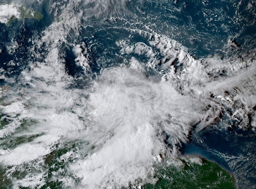
A Tropical Storm Warning is in effect for… * Grenada and its dependencies * St. Vincent and the Grenadines A Tropical Storm Watch is in effect for… * U.S. Virgin Islands * Puerto Rico, including Vieques and Culebra * British Virgin Islands Tropical storm conditions are expected within the warning area through this evening.
Tropical storm conditions are possible within the watch area beginning Tuesday morning. Interests elsewhere in the Lesser Antilles should monitor the progress of Karen.
Karen is expected to produce the following rainfall accumulations through Wednesday: – Windward Islands…3 to 6 inches, isolated 8 inches. – Puerto Rico and the Virgin Islands…2 to 4 inches, isolated 6 inches. – Leeward Islands…1 to 3 inches, isolated 5 inches. – Far northeast Venezuela and Barbados…1 to 3 inches. These rains may cause flash flooding and mudslides, especially in mountainous areas. For storm information specific to your area, please monitor products issued by your national meteorological service.
As of 5 p.m. AST/EDT, the center of Tropical Storm Karen was located about 85 miles (140 km) northwest of Grenada and about 360 miles (580 km) south-southeast of St. Croix. It’s moving toward the west-northwest near 13 mph (20 km/h).
A turn toward the northwest is forecast to occur later tonight or on Monday, followed by a turn toward the north on Tuesday. On the forecast track, the center of Karen will continue to move away from the Windward Islands this evening, and then move across the eastern Caribbean Sea tonight and Monday. On Tuesday, Karen is expected to pass near or over Puerto Rico and the Virgin Islands.
Maximum sustained winds are near 40 mph (65 km/h) with higher gusts. Tropical-storm-force winds extend outward up to 105 miles (165 km) from the center. Little change in strength is forecast during the next 48 hours. The next complete advisory will be issued by NHC at 11 p.m. AST/EDT with an intermediate advisory at 8 p.m. AST/EDT – www.hurricanes.gov

