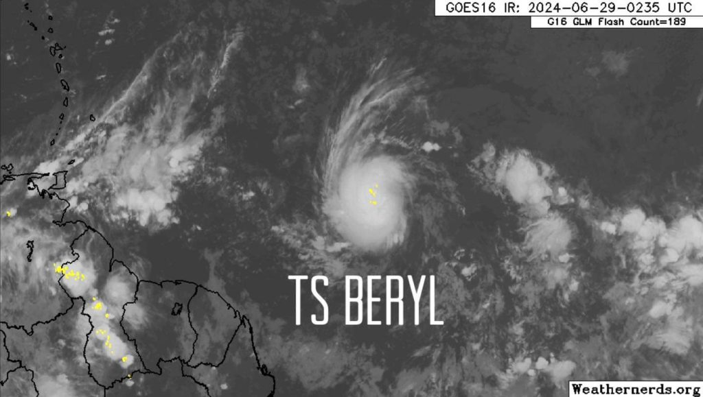
Tropical Storm Beryl: Windward Islands Bracing for Impact
Residents of the Windward Islands are urged to stay alert as Tropical Storm Beryl strengthens. Hurricane and Tropical Storm Watches are expected early Saturday.
Current Status of Tropical Storm Beryl:
- Location: 9.3°N, 43.6°W
- Movement: West at 18 mph (30 km/h)
- Minimum Pressure: 1006 mb
- Maximum Sustained Winds: 40 mph (65 km/h)
Advisory Highlights:
- Tropical Depression Beryl has intensified into a Tropical Storm and is forecasted to become a hurricane as it nears the Windward Islands.
- Interests in the Windward Islands should closely monitor the progress of Beryl.
- Hurricane and Tropical Storm Watches are likely to be issued early Saturday.
Forecast and Expected Impact:
Beryl is moving westward at 18 mph and is anticipated to maintain a westward to west-northwestward trajectory over the next few days. The storm is expected to cross the Windward Islands late Sunday night into Monday. Residents should prepare for possible hurricane conditions by Sunday night.
Rainfall and Flooding:
Tropical Storm Beryl is expected to bring 3 to 6 inches of rain to Barbados and the Windward Islands. This could result in localized flooding, especially in low-lying and flood-prone areas. Stay updated with the National Weather Service Storm Total Rainfall Graphic and the Flash Flood Risk graphic for detailed forecasts and potential flood risks.
Surf and Rip Currents:
Swells generated by Beryl are likely to reach the Windward and southern Leeward Islands by late Sunday, potentially causing life-threatening surf and rip currents. Beachgoers and mariners should exercise extreme caution and follow local advisories.
Next Advisory:
The next complete advisory will be issued at 5:00 AM AST. Stay tuned to local weather updates and heed any advisories or warnings issued by local authorities.
Stay safe and be prepared as Tropical Storm Beryl approaches.

