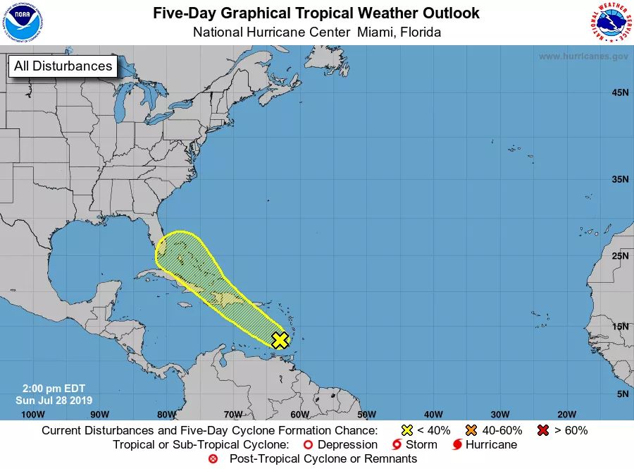
A persistent area of cloudiness and thunderstorms is located on this Sunday afternoon over the eastern Caribbean Sea and is associated with a tropical wave. This disturbance is expected to move west-northwestward to northwestward across the north-central Caribbean Sea during the next few days, producing locally heavy rainfall and possibly some flooding across Puerto Rico and Hispaniola. Little development of the disturbance is expected due to interaction with land. However, the system is forecast to emerge over the Straits of Florida by the end of the week where environmental conditions could be a little more conducive for development to occur. It has a low (20 percent) chance of tropical cyclone development during the next five days.
Get the latest on the tropics by going to the NHC website at www.hurricanes.gov


