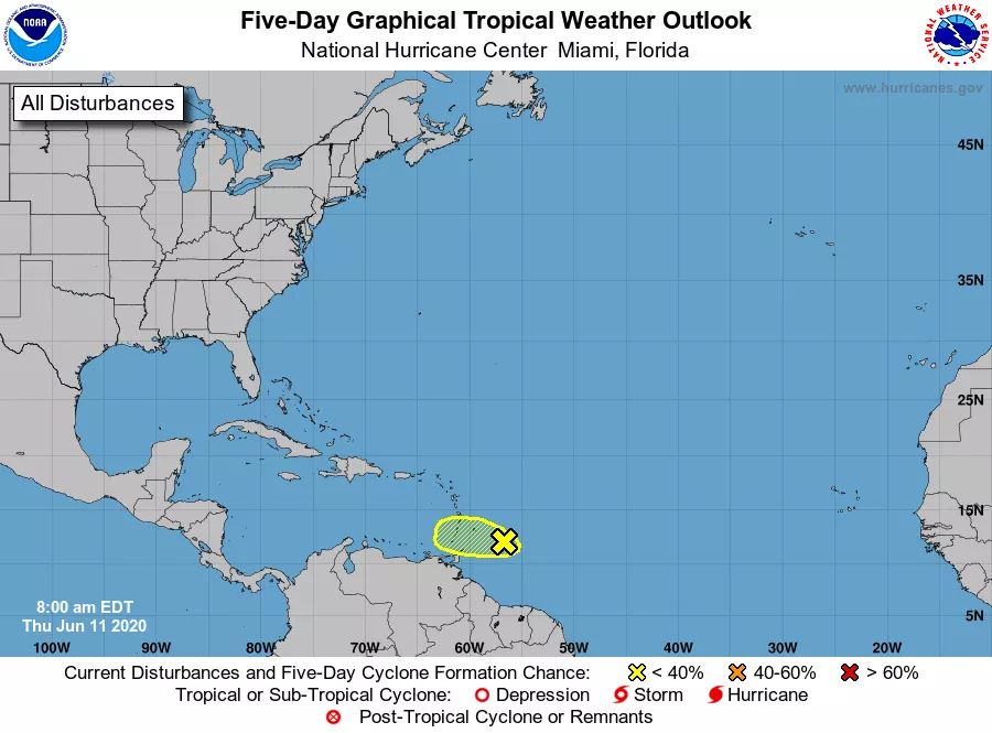
The St. Vincent and the Grenadines Meteorological Services continues to monitor the progress of a
strong tropical wave now near 13°N…56°W or about 345 miles (555 km) east of St. Vincent and the
Grenadines.
Although forecast models suggest that no further development is expected as the system approaches the
southern Windwards, gusty winds and pockets of moderate to heavy showers and isolated thunderstorms
are anticipated across SVG later today through Friday.
In addition, rainfall accumulations of 2 inches (50 millimeters) with isolated higher amounts are possible.
As a result, some flash-flooding are likely in low-lying areas.
Residents and motorists in areas prone to flooding, landslides and near rivers and streams should
remain alert.
The St Vincent and the Grenadines Meteorological Services will continue to monitor this system and
provide updates if conditions warrant.

