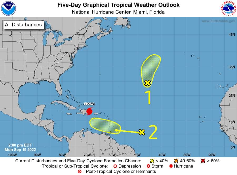
The St. Vincent and the Grenadines Meteorological Services continues to closely monitor the progress
of a westward moving tropical wave located near longitude 45° West, or about 1100 miles (1700 kilometers) east-southeast of the Windward Islands.
The latest model guidance suggests that environmental conditions could become more favourable for slow development of this system in several days while it is forecast to move across the Windward Islands and into the Caribbean Sea.
Regardless of development, this system is expected to produce moderate to heavy showers, thunderstorm activity and gusty winds across SVG by mid-afternoon Thursday. Due to the already saturated nature of the soils (especially across the northern areas of mainland SVG) from the recent rainfall event, flash-flood watches or warnings may be issued within the upcoming days.
A weather advisory for a low risk of flash-flooding remains in effect. Residents and motorists near the red and orange zones near the La Soufriere volcano should remain alert.
All residents are advised to keep informed and pay close attention to information being issued by the St. Vincent and the Grenadines Meteorological Services by visiting our website at
http://www.meteo.gov.vc/ or by following us on Facebook via, https://facebook.com/svgweather
This information statement is intended for preparedness purposes.

