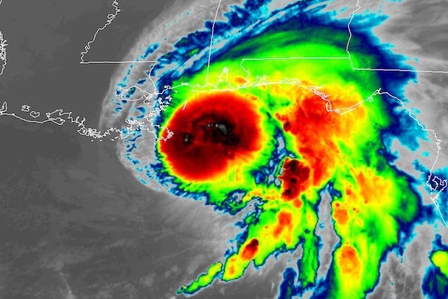
Hurricane Sally is slogging toward the northern Gulf Coast, where it threatens to unleash “historic” amounts of rain that could trigger “extreme life-threatening flash flooding” through at least Wednesday, according to the National Hurricane Center.
The NHC predicts the long-duration storm could produce as much as 30 inches of rain between southeastern Mississippi and the western Florida Panhandle, with widespread amounts of 10 to 20 inches.
In addition, NHC is calling for an “extremely dangerous and life-threatening storm surge” in coastal areas, though forecasts for surge heights have been lowered.
Heavy rain and tropical-storm force winds have already begun and the storm’s impacts are expected to intensify as Sally inches ashore into Wednesday near the Mississippi-Alabama border.
Tracking Sally
Sally’s plodding motion means a relentless pounding from wind and water lasting into Thursday will cover coastal zones from extreme southeast Louisiana to the western Florida Panhandle, which are under hurricane and storm-surge warnings.
The surge could cause the water to rise up to 7 feet above normally dry land from the Miss. border with Ala. to the Ala. border with Fla., including Mobile Bay, and coastal inundation could persist over multiple tidal cycles, along with pounding waves.
Winds gusts over 70 mph are likely to cause damage, downed trees, and widespread power outages, especially close to where Sally comes ashore. Tornadoes could also be embedded in rain bands that move ashore.
Here are some significant developments:
- Sally’s peak winds have maintained at 85 mph through 11 a.m. ET Tuesday, which makes the storm a Category 1 hurricane. It is forecast to hold at this intensity through landfall. Water, not winds, is its biggest threat.
- The storm track shifted slightly east on Monday, with landfall now projected near the Mississippi-Alabama border. Given the shift, New Orleans is no longer under a tropical storm warning or a hurricane warning.
- The timing of landfall is more uncertain than usual, but is currently projected to occur during the day Wednesday.
Source: Washington Post

